Introducing Responder and Station – A New Era of Response

Today, we’re thrilled to unveil the first ever end-to-end Drone as First Responder (DFR) solution with the Responder drone and Responder Station automated charging nest. This integrated platform seamlessly links with 911 and Computer-Aided Dispatch (CAD) systems to enable the autonomous deployment of drones to 911 calls and other emergencies.
The First End-to-End DFR Solution
Previously, DFR operations have relied on general-purpose drones, a variety of 3rd party software products / accessories, and incomplete integrations. Responder, Station, and LiveOps represent the first solutions purpose built for public safety DFR operations. This focused approach has enabled us to make a wide variety of mission-specific decisions, making the BRINC DFR solution the most integrated, capable, and easy to implement solution to date.
Table of Contents
Identifiable During an Emergency
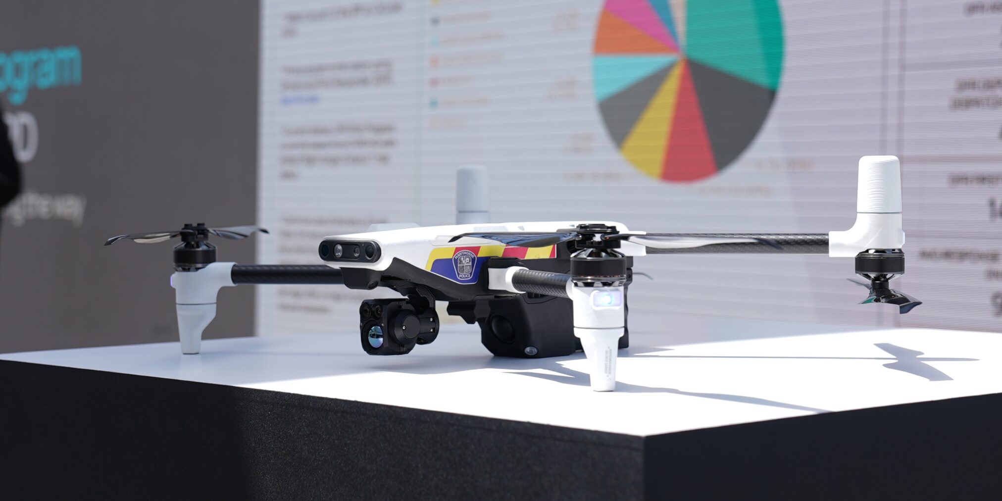
Responder is an emergency response vehicle, not your everyday gray consumer drone. With integrated emergency lights, customizable agency markings and a siren this drone was built to be quickly identified.
Operate From Anywhere
Responder is multifaceted, supporting first responders as an agency’s automated DFR drone, as a patrol-led DFR bird, or as a manually deployed drone.
In addition to its versatile deployment options, Responder has an integrated 4G LTE modem that allows for both live video streaming, and full teleoperation, in other words drone flight from a laptop, from anywhere.
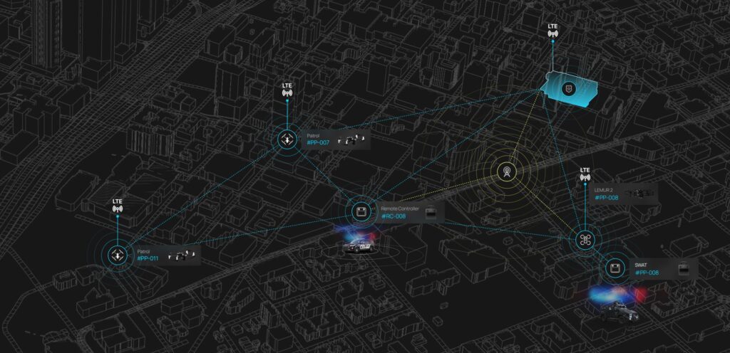
Responder retains BRINC’s mesh networking system. This means all Responders, Stations and controllers will extend each other’s range. This applies across BRINC’s entire ecosystem, so Responders can extend the range of Lemur 2s. If a Lemur 2 is indoors and Respond is overhead, Responder can act as an aerial repeater, dramatically extending the range of the Lemur 2.
Coverage can be further expanded with additional stand-alone repeater sites throughout a community to guarantee connectivity.
Powerful Cameras for Informed Decision Making
The gimbal payload on Responder includes a powerful zoom camera and a high resolution thermal imager. The zoom camera uses two different camera sensors with different lenses, optical zoom and some sophisticated software to digitally blend or switch between cameras depending on the needs of the situation.
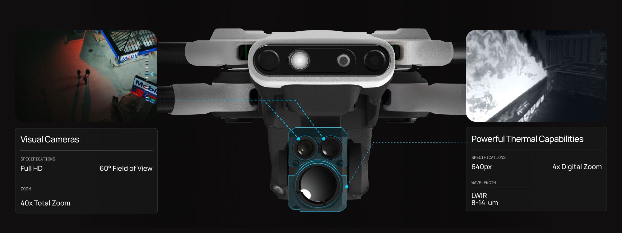
The thermal camera on Responder has a 640 px resolution to visually identify temperature differences, even in low or no light conditions. Being able to see temperature makes it easy to locate hot spots during structure fires, find lost or injured individualsheat signatures and gather other crucial intelligence.
Communicate in High Risk Situations
Responder has an industry-leading two-way audio system, now enhanced with a powerful siren audible up to 800 feet away. This feature enables users to communicate their presence, deliver instructions, or help de-escalate potentially dangerous situations more effectively.
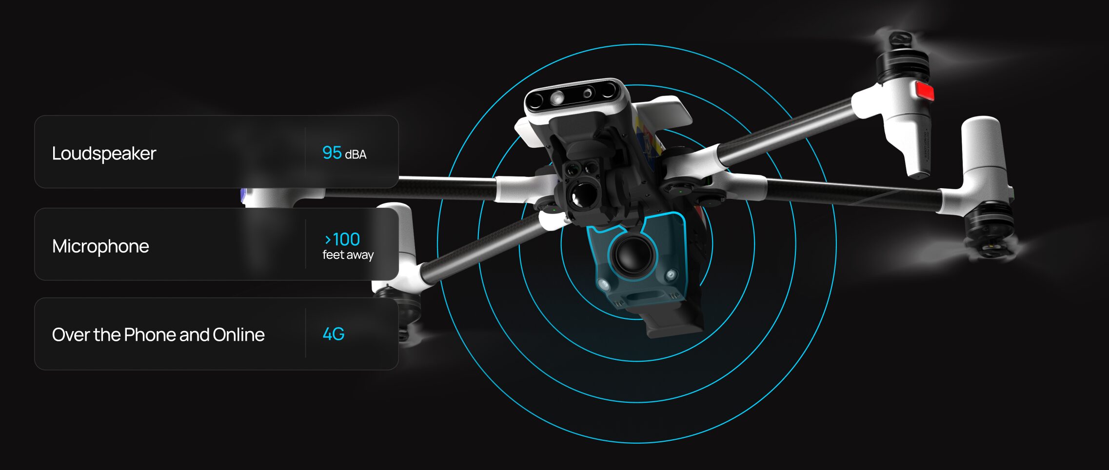
Activation of the loudspeaker can be done by simply calling the drone’s dedicated cell phone number or via LiveOps, ensuring flexibility and ease of use during critical operations.
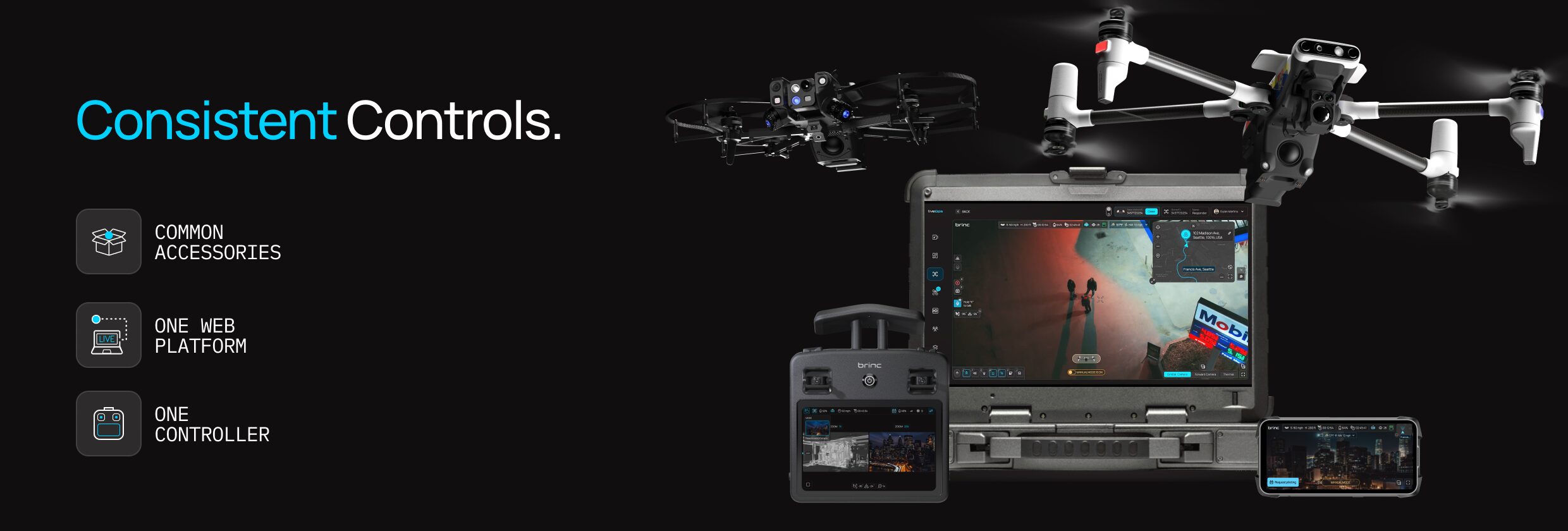
Common Controller and Accessories
Lemur 2 and Responder share a common controller, charger, accessories, mesh radios, software, and more. With BRINC you do not have to worry about managing a dozen different drones, chargers, controllers, software vendors, etc. You can standardize on a single solution, get fully trained and focus on the mission.
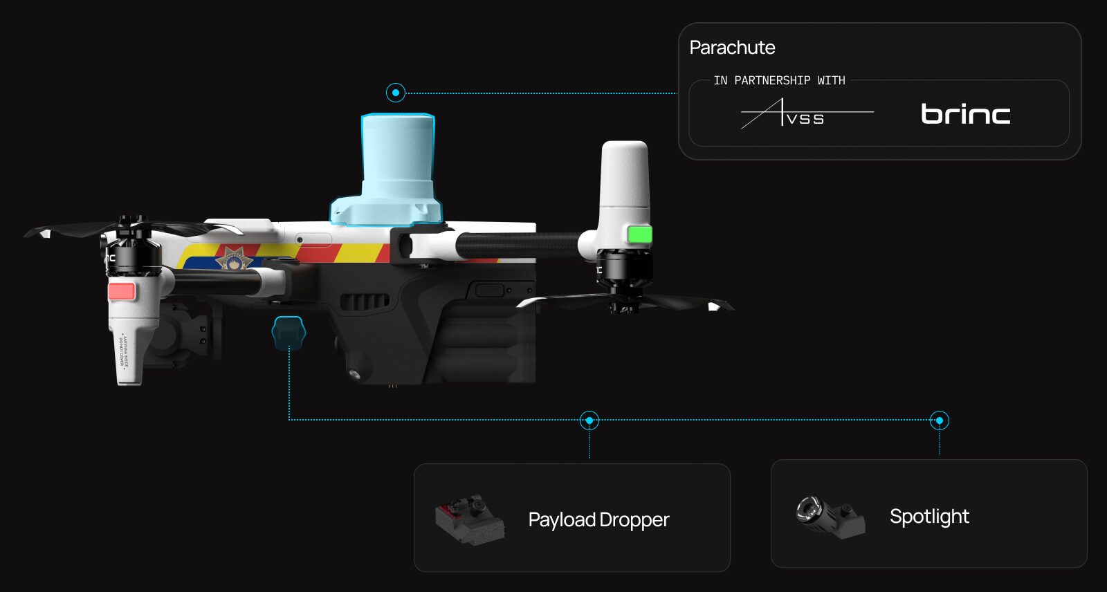
Attachments for Advanced Operations
We built Responder with modularity in mind. The drone has the same attachment rail as Lemur 2 and can be equipped with a dropper or spotlight. Responder also has a mounting point for an emergency parachute system to improve safety in city based deployments.
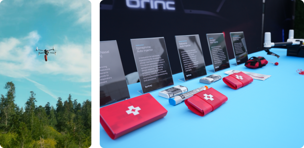
Emergency Deliveries
When Responder is deployed in cities, life saving supplies can always be made available within 90 seconds. The drone is capable of delivering EpiPens, Narcan, AEDs, PFDs and more.
Intelligent Autonomy Systems
Responder is equipped with a range of advanced sensors and illuminatorslights to enhance its functionality, safety, and ease of use in various conditions.
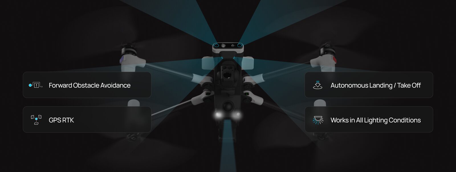
These features collectively make Responder an intelligent, autonomous, and upgradeable platform capable of precise operations. Here’s a closer look at each feature and its role in the system:
Front Facing Obstacle Avoidance Sensors: These sensors help Responder detect and navigate around obstacles in its path, improving safety and reliability in complex environments.
GPS RTK (Real-Time Kinematics): This technology enhances GPS data accuracy, providing centimeter-level positioning which is crucial for precise operations like mapping.
Multiple Redundant Tracking Cameras and LiDAR: These sensors offer additional layers of flight stability by providing multiple visual feedback streams, ensuring reliable navigation and assisting in autonomous landings in Stations.
Integrated Lighting Systems: Downward facing lighting turns on when landing to ensure the cameras have enough light to detect the ground or to see the landing markers in Station.
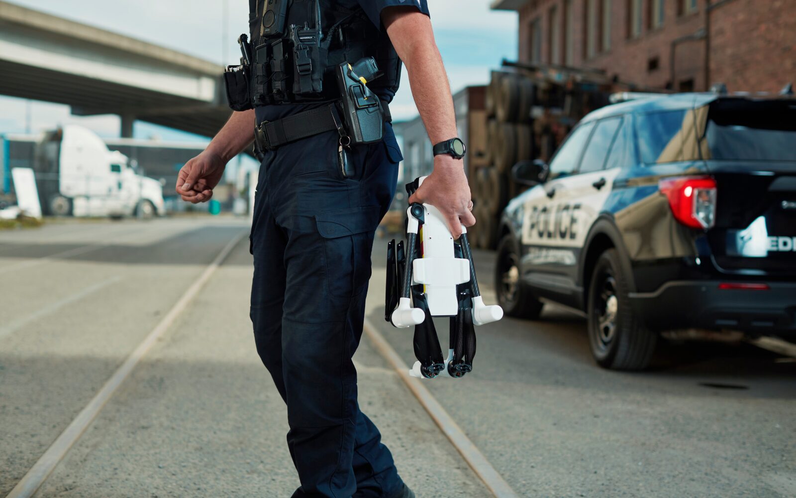
Portable Design
The Responder drone features a portable design, utilizing lightweight and durable materials to facilitate easy transportation. Its arms and props can be swiveled to reduce its size, allowing it to fit snugly into a compact case, making it an ideal choice for rapid deployment in the field.
Responder Station
Today, we are excited to announce another significant piece of hardware: Responder Station – a robotic drone recharging nest for Responder.
Designed to be mounted at police and fire stations or other strategic locations within a community, the Station charges, protects, and deploys the Responder drone. Tailored specifically for DFR operations, it is capable of launching drones to emergencies in less than five seconds.
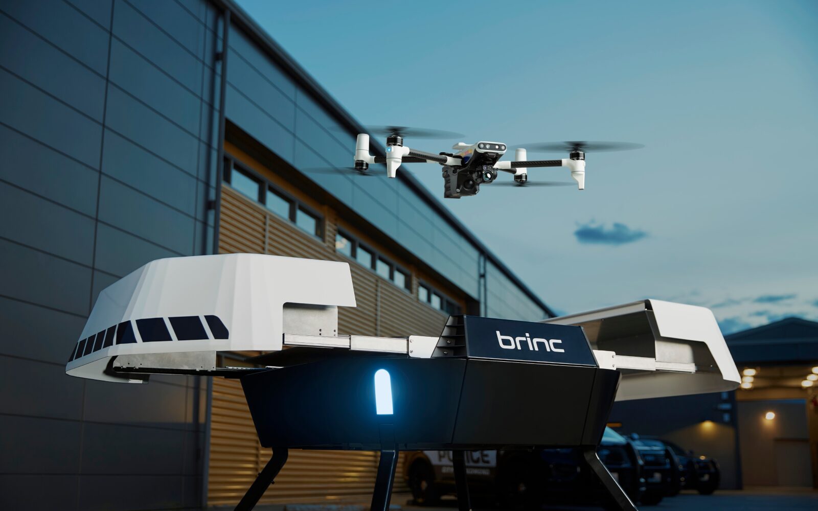
Station is built to withstand extreme weather conditions, ensuring reliable performance no matter the environment. Its installation is straightforward, requiring only an ethernet connection and a 110V outlet.
Additionally, Station can be mounted on large vehicles or set up in remote locations, utilizing Starlink and solar panels for enhanced connectivity and energy independence.
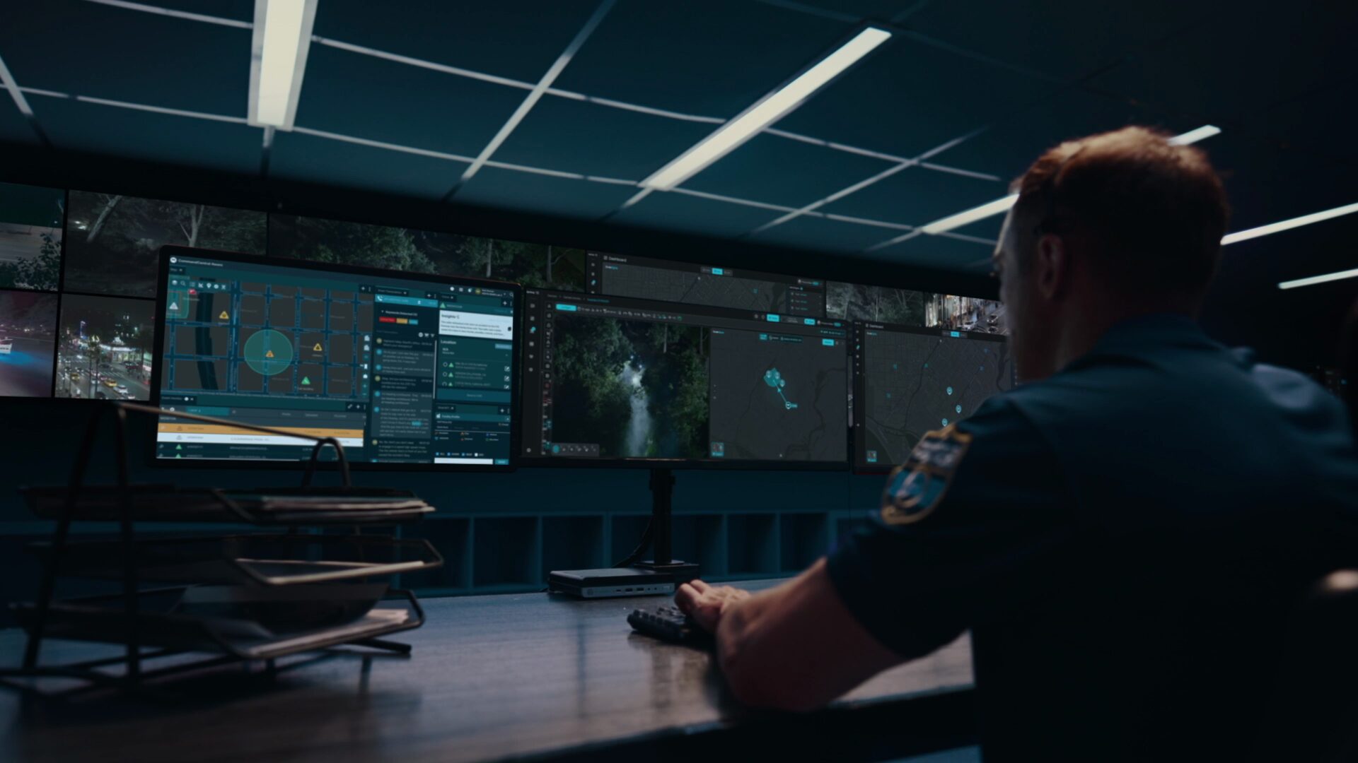
LiveOps: Unified Drone Operations Software
BRINC DFR is driven by LiveOps, a drone operations software platform available on all modern web browsers. This allows for easy access on mobile devices, tablets, mobile data computers, and at real-time crime centers.
Teleoperations
Operate Station and Responder directly from LiveOps from anywhere in the world using just a browser tab and your arrow keys. LiveOps enables district-wide deployments by displaying calls for service and available drones, selecting a Station to launch from, and quickly deploying Responder drones to emergencies.
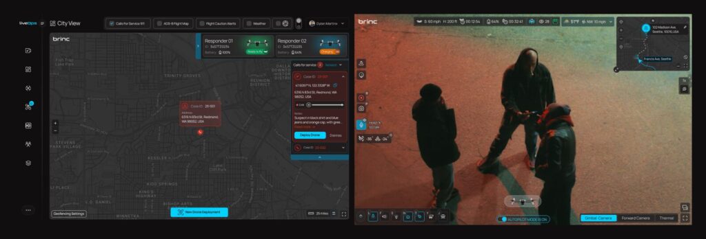
More than just remote piloting, LiveOps allows for the control of Responder’s payload dropper, spotlight attachment, and 2-way audio system.
Augmented Reality Overlays
LiveOps now supports augmented reality overlays on drone video feeds. This functionality superimposes street names directly onto the actual streets in the video feed, displays columns of light to indicate call for service locations, and can integrate with body camera GPS positions to show the locations of officers on the ground.
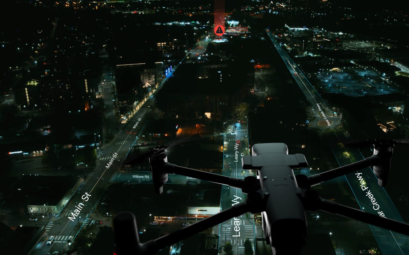
This enhancement greatly simplifies the communication of details to units on the ground, improving coordination and response efficiency.
Integrations
The most powerful aspect of LiveOps is its ability to be integrated with a wide variety of pre-existing public safety systems, making the implementation of BRINC DFR straightforward. At launch, LiveOps is integrated with Live911, which provides 911 call locations and allows teleoperators to hear live 911 call audio to improve situational awareness.
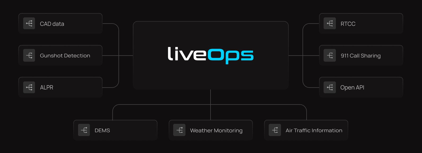
LiveOps can also receive call-for-service locations directly from CAD systems, making DFR deployments even quicker.
Additionally, LiveOps has the capability to instantly stream video to Real-Time Crime Centers (RTCC) and can coordinate the deployment of drones in response to specific incidents, such as gunshot detections or automated license plate recognition (ALPR) alerts.
All drone footage can be seamlessly uploaded to Digital Evidence Management Systems (DEMS). This integration facilitates efficient archiving, retrieval, and management of video data, ensuring that all footage is easily accessible and securely stored.
Critical weather data is also displayed to ensure the safety and efficiency of drone operations. This feature allows operators to monitor real-time weather conditions, including wind speeds, precipitation, and temperature, which can significantly affect drone performance.
LiveOps enhances safety by displaying Automatic Dependent Surveillance-Broadcast (ADS-B) data, providing real-time locations of nearby crewed aircraft. This feature allows teleoperators to maintain situational awareness and manage airspace effectively.
Together, these features create an integrated response system that improves the overall efficiency and effectiveness of DFR operations.
BVLOS Without a VO
A significant barrier to DFR operations historically has been the FAA regulatory requirement for a visual observer (VO) on beyond visual line of sight (BVLOS) missions. This requirement necessitates having a person, typically positioned on a rooftop, actively scanning for manned aircraft to prevent collisions.
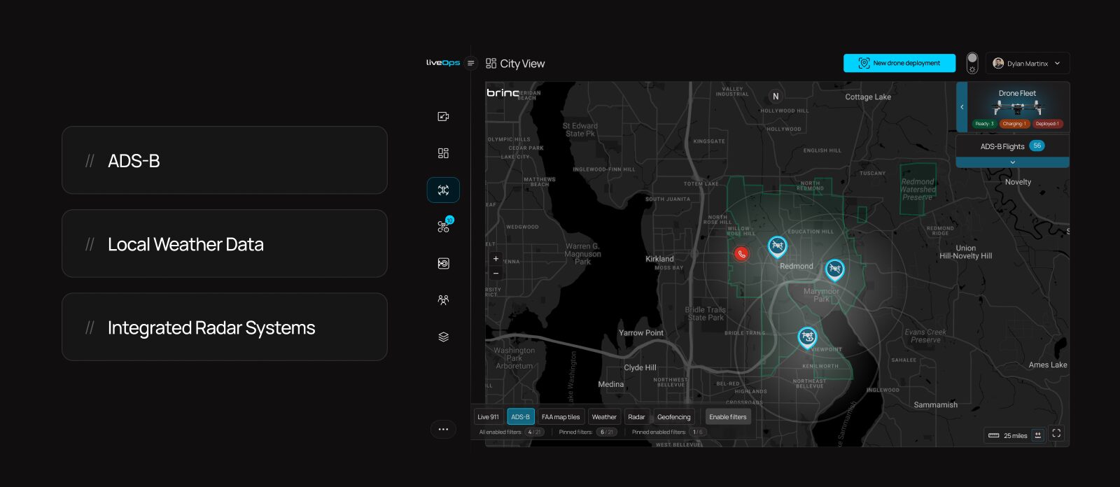
This adds cost and complexity to DFR deployments due to the additional staffing requirement. However, a promising solution exists. LiveOps integrates data from ADS-B and ground-based radar systems to detect nearby aircraft and strategically reroute drones to avoid them.
BRINC is working to enable operations without a VO using this technology. We have partnered with Echodyne, a leading radar manufacturer, to achieve this. This development will significantly broaden the accessibility of DFR technology to nearly all agencies.
Built With Communities in Mind
We believe that DFR will be a tremendous social good, and save many lives. However, we are aware this is a powerful technology, and we have designed it with communities in mind. In pursuit of this goal, BRINC has made a commitment against weaponizing our products.
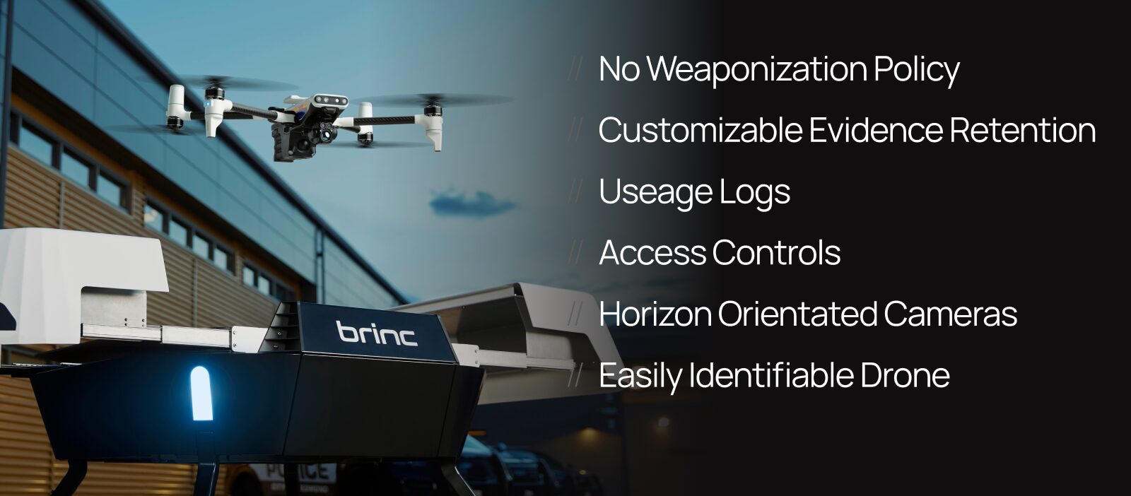
In addition, we have developed a suite of tools designed to help agencies effectively manage their DFR programs. These tools include configurable data retention settings and usage logs that link pilots to specific missions, as well as automated camera adjustments that swivel the drone’s gimbal to neutral positions during flights to and from emergencies.
Additionally, our drones are also easily identifiable as public safety vehicles, ensuring transparency. We are dedicated to ensuring that this technology provides significant benefits to the communities where it is implemented, and that it is used responsibly.
Public Transparency Portal
We have also developed a public transparency portal to enhance community understanding of DFR operations. This portal displays program statistics, such as the number of DFR flights conducted, average response times, and the types of emergencies most frequently addressed by the drones.
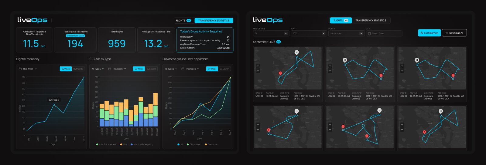
The transparency portal also provides historical flight paths and the specific purpose of each mission. If community members are curious about the presence of an emergency response drone, they can easily access the portal to view detailed information about the flight’s purpose, launch time and flight path for greater transparency.
Built with Security in Mind
BRINC technology is meticulously designed with robust security measures at its core. All our hardware is NDAA compliant, ensuring that no silicon or sensors are sourced from China—a significant achievement given that the global drone supply chain is based in China.
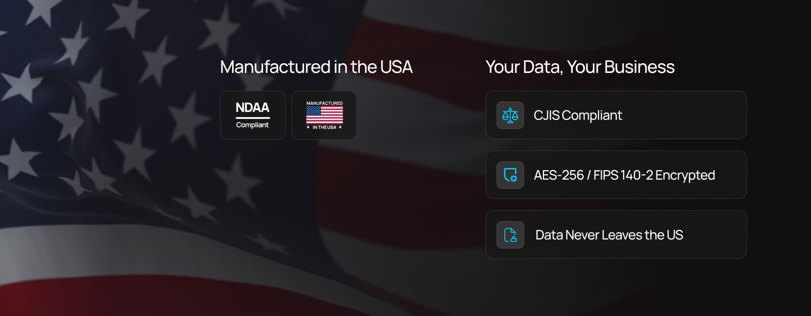
Despite these challenges, we have successfully localized production, with all hardware assembled at our headquarters in Seattle, WA. Additionally, LiveOps is CJIS compliant, hosted on AWS servers in the U.S., and all data is encrypted to safeguard information integrity and privacy. At BRINC, we prioritize security to the highest degree, reflecting our commitment to delivering safe and reliable American technology solutions.
BRINC Safeguard
Our technology is available to purchase à la carte or through BRINC Safeguard, which offers comprehensive hardware upgrades, replacements, software, support, COA services and more. With Safeguard, partners receive automatic upgrades to the latest BRINC hardware upon release, unlimited replacements for drones that are damaged or destroyed, LiveOps licenses, and complete Station installation and maintenance.
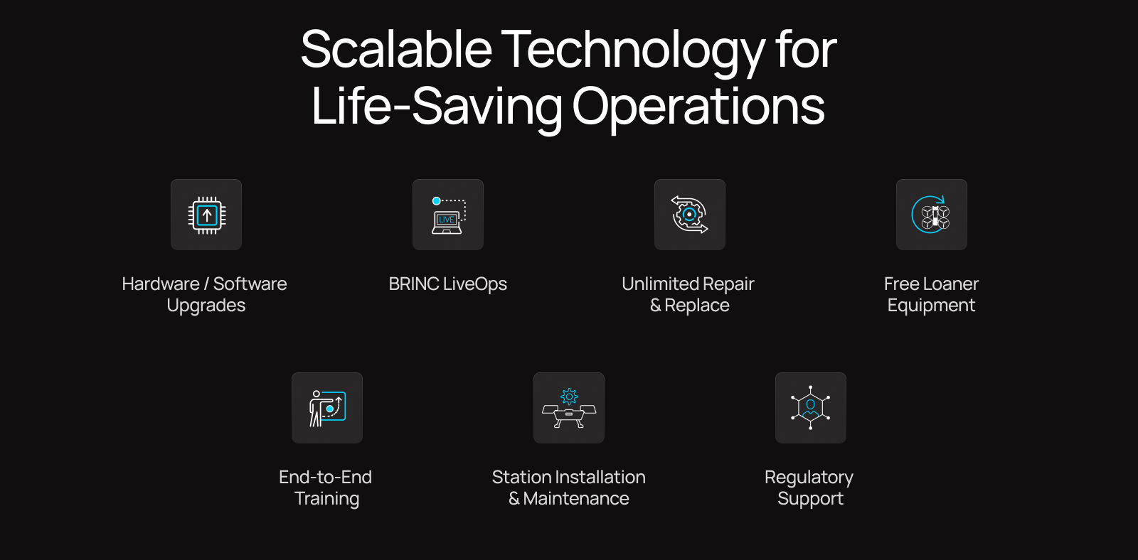
The Safeguard program also provides regulatory assistance – such as help with applying for COAs and BVLOS waivers. This comprehensive service ensures that agencies can establish and maintain a drone program with budgetary certainty. Safeguard is an excellent way for agencies to partner with us, providing them with a seamless and efficient solution for integrating drone technology into their operations.