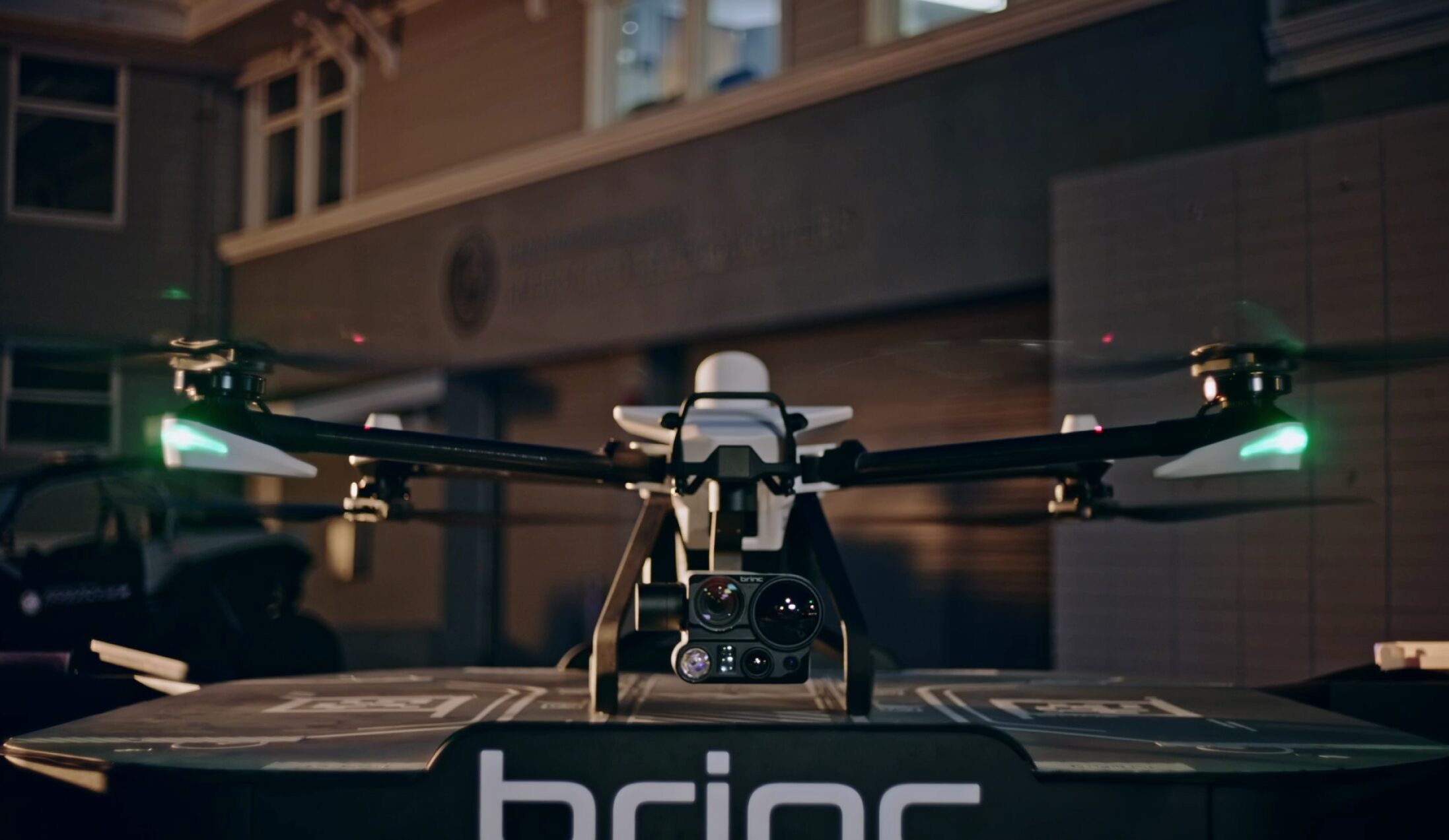
The Path to No VO BVLOS DFR Operations

As agencies across the nation consider building out Drone as First Responder (DFR) operations, where drones are pre-positioned in robotic charging nests to immediately deploy to calls for service, they all encounter the same challenge – how to meaningfully operate at scale under the current FAA Beyond Visual Line of Sight (BVLOS) rules.
Visual Observers (VOs) and the Limitations of Current Operations
Current FAA guidelines require a pilot to monitor the airspace at all times. To circumvent this, many agencies with DFR programs staff Visual Observers (VOs) on rooftops to communicate with the Remote Pilot in Command (RPIC). The RPIC launches, maneuvers, and lands the drone, while the VO observes the airspace around the drone.
While this setup works, it constrains DFR operations, and limits the benefits an agency can provide to its community. Staffing constraints, weather and visibility, and costly maintenance of 24/7 operations pose the most significant limitations. Consequently, many programs limit the hours of operations, even though calls for service can occur at any time during a 168-hour week.
Many agencies are developing unique Concepts of Operations (CONOPS) to obtain FAA waivers for more expansive BVLOS operations without VOs. BRINC has been working with agencies to develop best practices and support agencies in scaling the infrastructure needed for these operations. Below is a further discussion of our approach, in which one agency has a waiver submission currently being reviewed by the FAA. While we are optimistic that the CONOPS will be accepted, we remain ready to adapt based on the FAA’s feedback to help agencies nationwide scale these life-saving operations.
Fused Airspace Awareness on a Single Platform
To help agencies work towards advanced DFR programs with BVLOS operations, BRINC has designed a single unified view for airspace awareness through its LiveOps drone operations management software and accompanying detection hardware. This pulls in ADS-B data, ground-based radar, weather information, airspace advisories and more to inform the RPIC of the surrounding airspace. Prediction systems trigger automatic alerts to the RPIC and can even initiate an autonomous safe landing if needed.
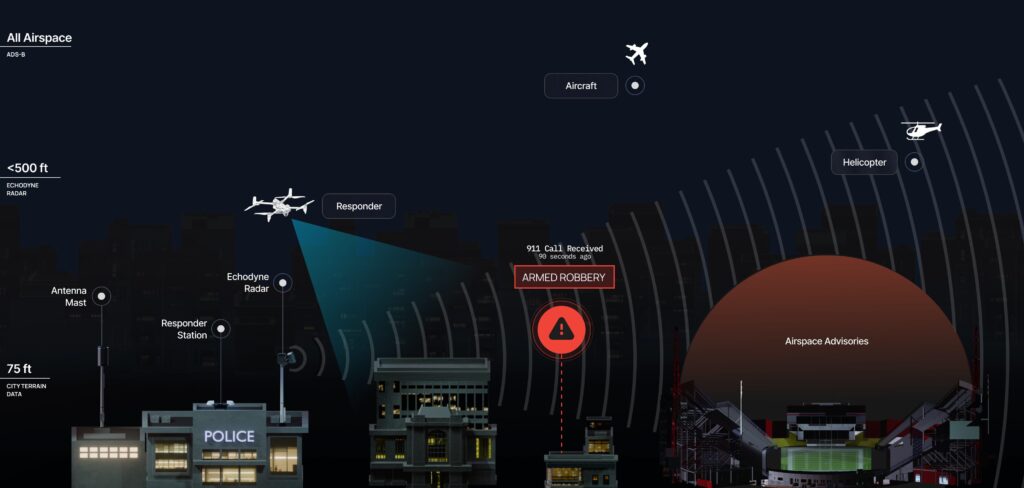
ADS-B Data:
ADS-B (Automatic Dependent Surveillance-Broadcast) is a technology used by aircraft to broadcast their location, speed, and other data to air traffic control and nearby aircraft. The FAA mandates ADS-B Out for most aircraft operating in controlled airspace within the US, making ADS-B data critical for drone systems to account for broader airspace traffic.
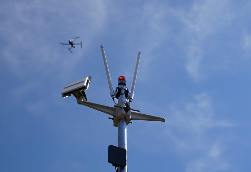
Ground-Based Radar:
While ADS-B provides comprehensive airspace awareness, dual redundancy is essential for enhanced safety. Ground-based radar complements ADS-B by identifying any moving object in the operational area, typically between 75 to 400 feet, with an additional buffer (often 100 feet). This technology provides a more complete picture of our operational airspace, accommodating aircraft that may not be ADS-B compliant.
Integrated Weather Data:
Integrated weather data provides both real-time and forecasted information on current weather conditions. This offers operators a complete understanding of environmental factors that could impact drone flight operations, enhancing the safety and efficiency of their missions.
Identifying the Right Awareness System – BRINC & Echodyne
Choosing the right awareness system is essential when working towards BVLOS without a VO. This choice is vital for gaining FAA approval and ensuring long-term operational success. The industry has engaged in numerous awareness system discussions, yet many agencies still grapple with unanswered questions. There is confusion because several agencies have secured limited waivers and significant attention despite using technologically limited solutions that aren’t sustainable long-term.
Some systems rely on visual cameras that function similarly to a drone’s onboard cameras, effectively replicating the pilot’s eyes. While these systems have successfully secured waivers, they face substantial limitations akin to those of visual observers. These systems struggle to detect obstructions in low light and adverse weather conditions, restricting DFR operations to daytime and favorable weather.
Others use traditional radar purchased through “Counter Unmanned Aircraft Systems (UAS)” companies, which act as intermediaries between agencies and radar suppliers. This increases agency costs, as these firms may switch to less robust systems in later years to increase profits.
BRINC is directly partnering with Echodyne, the leader in radar technology, to deliver an advanced yet cost-effective solution. Echodyne’s cutting-edge MESA® radar has been trusted by the FAA’s Centers of Excellence for UAS and NASA testing programs, and it has played a critical role in securing U.S. military bases worldwide. By integrating Echodyne radar into BRINC’s DFR solution, agencies can achieve BVLOS without the need for a VO, ensuring streamlined operations and long-term performance.
Get Started
Partner with BRINC to get started with DFR without a VO. Contact us to get started with assessing where Echodyne radars could be installed in your jurisdiction.